EO:EUM:DAT:1096
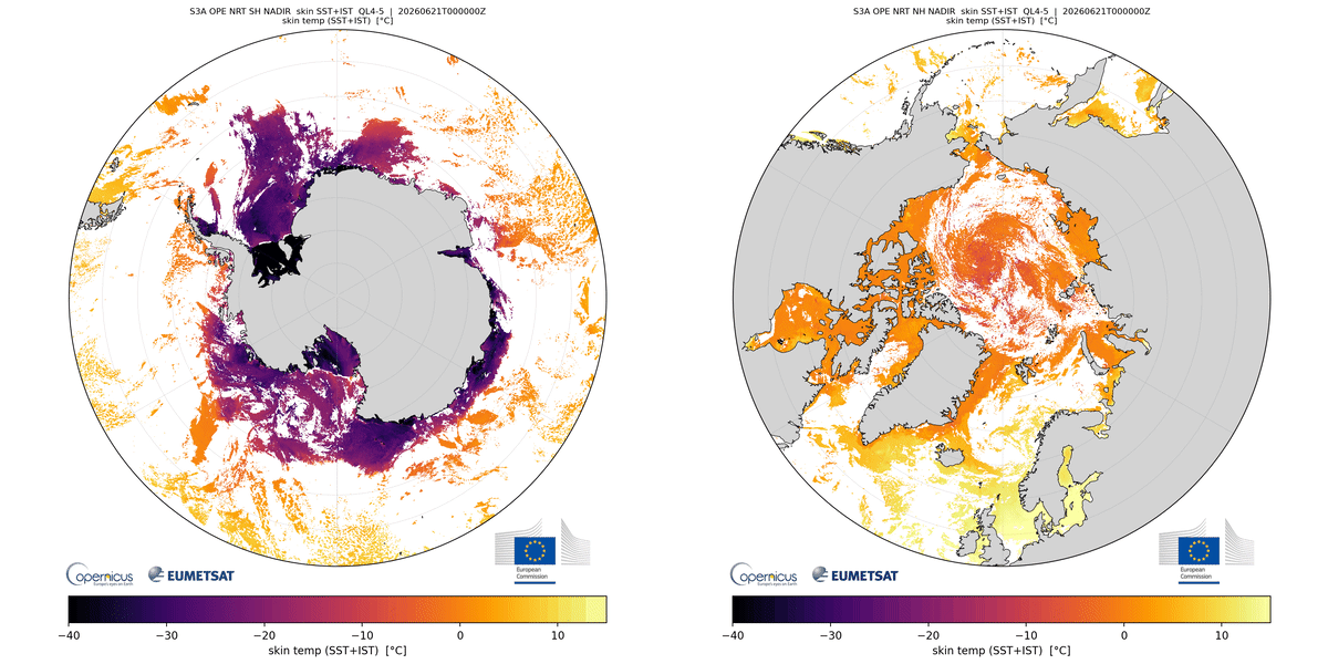 SLSTR Level 2 Ice Surface Temperature - Sentinel-3
The Copernicus Sentinel-3 SLSTR Level-2 Ice Surface Temperature (IST) product extends
the existing marine SST portfolio to the cryosphere by providing surface skin temperature
over sea-ice and water poleward of 50° latitude in both the Northern and Southern
Hemispheres, in both Near Real Time (NRT, < 3 hours) and Non Time Critical (NTC, <30
days) timeliness as ~3 min granules. Ice surface temperature is one of a key climate
variables that influences energy exchange between the surface and atmosphere, sea-ice
growth and melt processes, and the monitoring of polar climate change.
Key features include two complementary retrieval algorithms: a nadir-only split-window
retrieval and a dual-view single-channel retrieval, distributed in separate NetCDF
files. A unified surface temperature field combines SST, IST, or a weighted mixture
depending on surface type. Cloud screening is based on the EUMETSAT NWC SAF Polar
Platform System (PPS) cloud products, while auxiliary sea-ice concentration data support
surface classification into ocean, ice, and mixed pixels.
The product provides per-pixel quality levels, total and component uncertainties,
and GHRSST-compliant metadata and file formats.
Validation against Polar weather stations and airborne observations demonstrates that
quality levels 4 and 5 meet the GCOS target accuracy requirement of 3 K, with typical
daytime bias and standard deviation below 2 K for both retrieval algorithms. The product
is generated using the SLSTR SST/IST Instrument Processing Facility (IPF) v07.00 and
establishes an operational capability for monitoring surface temperature across both
polar oceans and sea-ice regions, supporting climate monitoring, numerical weather
prediction, sea-ice modelling, and operational polar applications.
Satellite: Sentinel-3
Instrument: SLSTR
Temporal Extent: 2026-06-11 -
now
Orbit Type: LEO
Data Policy: Copernicus
Browse productsShow this collection's OpenSearch Description Document
