EO:EUM:DAT:0921
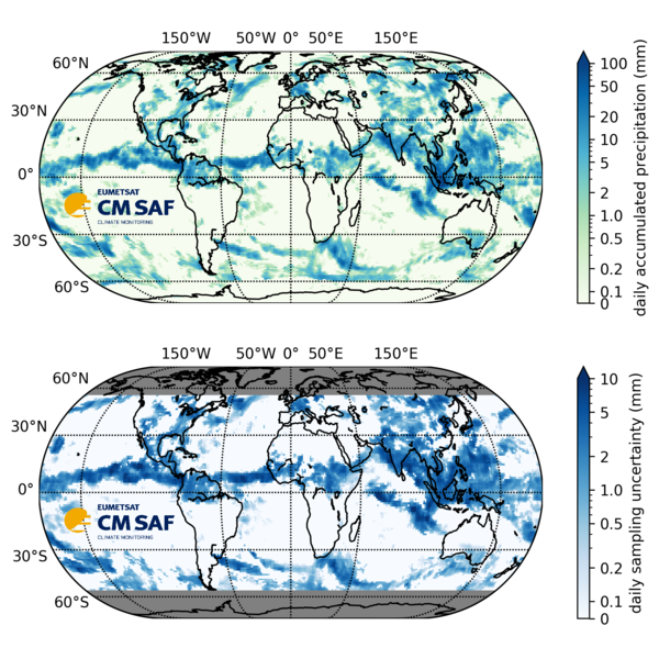 GIRAFE v1: CM SAF Global Interpolated RAinFall Estimation version 1
The GIRAFE v1 climate data record (CDR) provides precipitation estimates derived from
a combination of passive microwave (PMW) observations onboard polar orbiting satellites
and infrared (IR) observations onboard geostationary satellites. The GIRAFE v1 CDR
covers the time period 2002/01/01 until 2022/12/31 and is extended to the present
day by the GIRAFE v1 Interim CDR from 2023/01/01 with a latency of 10 days to three
months.
The PMW input to GIRAFE v1 is from various microwave imager and sounder instruments.
Precipitation rate estimates are retrieved from the observed PMW brightness temperatures
by precipitation retrieval algorithms HOAPS, PNPR-CLIM*, and PRPS. The resulting archives
of instantaneous precipitation rate estimates are homogenized using quantile mapping.
The IR input to GIRAFE comes from the five geostationary positions forming the Geo-Ring,
providing observations along all geographical longitudes. The spatially and temporally
highly resolved IR input is trained to detect the occurrence of precipitation using
the PMW-based instantaneous precipitation rate estimates. Conditional precipitation
rates are computed based on PMW observations only. At latitudes higher than 55°N/S
where Geo-Ring IR pixels are extremely distorted, GIRAFE v1 relies only on the PMW
input.
GIRAFE v1 is a gridded product which is available globally at a spatial resolution
of 1° x 1° and at a temporal resolution of 24 h as accumulated precipitation computed
from the (IR-based) fraction of precipitation and the conditional precipitation rate.
Additionally, 1° x 1° monthly mean values of the daily accumulated precipitation are
provided.
The daily accumulated precipitation features a dedicated sampling uncertainty at the
same 1° x 1° x 24 h resolution which is based on the analysis of decorrelation scales
in space and time in the IR-based precipitation fields.
* The PNPR-CLIM algorithm has been developed by CNR-ISAC in the C3S_312b_Lot1 Copernicus
project.
Satellite: Instrument: Temporal Extent: 2002-01-01 -
now
Orbit Type: GEO
Data Policy: NoConditions
Browse productsShow this collection's OpenSearch Description Document
