EO:EUM:DAT:0582
 SLSTR Level 2 Sea Surface Temperature (SST) (version BC003) - Sentinel-3 - Reprocessed
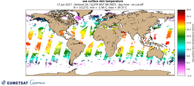
The SLSTR SST has a spatial resolution of 1km at nadir. Skin Sea Surface Temperature
following the GHRSST L2P GDS2 format specification, see https://www.ghrsst.org/ .
Sentinel-3 is part of a series of Sentinel satellites, under the umbrella of the EU
Copernicus programme.
This collection contains reprocessed data from baseline collection 003. Operational
data can be found in the corresponding collection.
Satellite: Sentinel-3
Instrument: SLSTR
Temporal Extent: 2016-04-18 -
2018-04-04
Orbit Type: LEO
Data Policy: Copernicus
Browse productsShow this collection's OpenSearch Description Document
