EO:EUM:DAT:0398
 Fire Risk Map - Released Energy Based - MSG
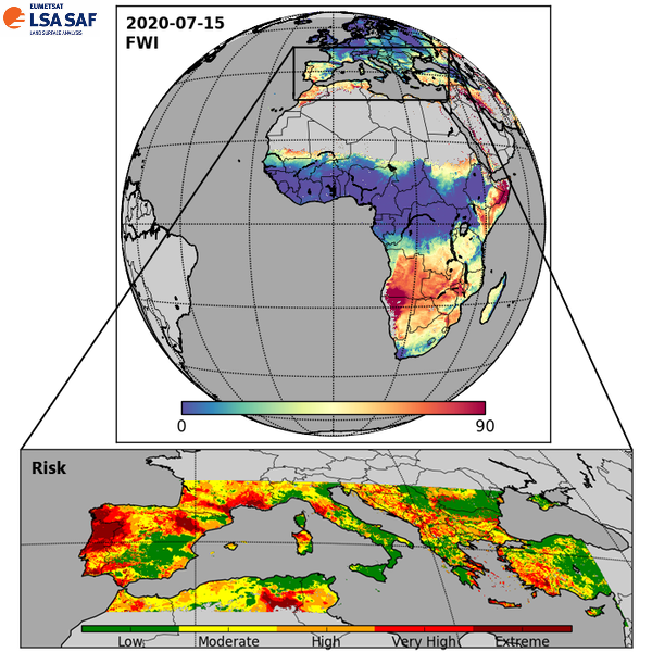
Fire risk by merging NWP & remotely sensed (FRP) data. The product includes 24h, 48h,
72h, 96h and 120h forecasts of: risk of fire (5 classes) and the probability of ignitions
reaching energy releases over 2000GJ (both covering Southern Europe); Fire Weather
Index (FWI) and respective components estimated for the whole MSG disk.
Satellite: MSG
Instrument: SEVIRI
Temporal Extent: 2023-09-21 -
now
Orbit Type: GEO
Data Policy: NoConditions
Browse productsShow this collection's OpenSearch Description Document
