EO:EUM:DAT:1087
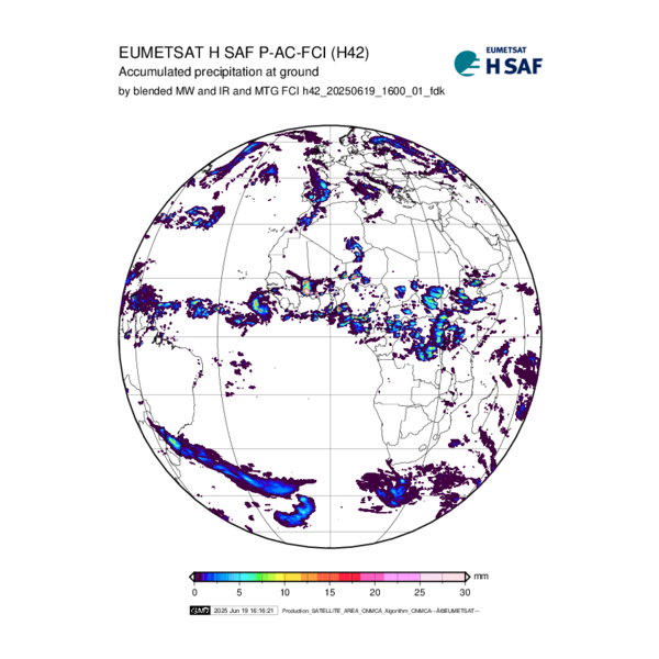 Accumulated precipitation at ground by blended MW+IR and FCI - MTG - 0 Degree
Derived from precipitation maps generated by merging MW images from operational sun-synchronous
satellites and IR images from geostationary satellites.
Integration is performed over 3, 6, 12 and 24 h. In order to reduce biases, the satellite-derived
field is forced to match raingauge observations and, in future, the accumulated precipitation
field outputted from a NWP model
Satellite: MTG
Instrument: FCI
Temporal Extent: 2025-08-14 -
now
Orbit Type: GEO
Data Policy: NoConditions
Browse productsShow this collection's OpenSearch Description Document
