EO:EUM:DAT:1086
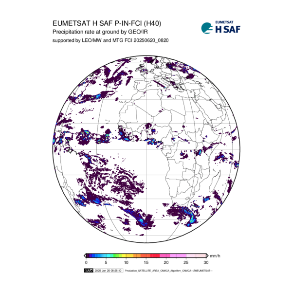 Precipitation rate at ground by blended FCI IR / LEO MW precipitation - MTG - 0 Degree
An instantaneous precipitation map is generated by IR images from the MTG FCI “calibrated”
by precipitation estimates from MW radiometers on board LEO satellites, processed
soon after each acquisition of a new image from MTG-FCI. The calibration procedure
will be carried out after each PMW radiometer overpass.
Satellite: MTG
Instrument: FCI
Temporal Extent: 2025-08-14 -
now
Orbit Type: GEO
Data Policy: NoConditions
Browse productsShow this collection's OpenSearch Description Document
