EO:EUM:DAT:0415
 SRAL Level 2 Altimetry Global - Sentinel-3
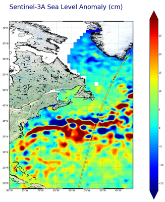
All Sentinel-3 NRT products are available at pick-up point in less than 3h. The products
contain the typical altimetry measurements, like the altimeter range, the sea surface
height, the wind speed, significant wave height and all required geophysical corrections
and related flags. Also the sea Ice freeboard measurement is included. The measurements
in the standard data file provide the measurements in low (1 Hz = approx. 7km) and
high resolution (20 Hz = approx. 300 m), in LRM mode or in SAR mode, for both C-band
and Ku band. The SAR mode is the default mode. The reduced measurement data file contains
1 Hz measurements only. The enhanced measurement data file contains also the waveforms
and associated parameters and the pseudo LRM measurements when in SAR mode. Sentinel-3
is part of a series of Sentinel satellites, under the umbrella of the EU Copernicus
programme. This product contains the following datasets: Sea Level Global(NRT) (PDS_MG3_CORE_14_GLONRT),
Sea Level Global Reduced(NRT)(PDS_MG3_CORE_14_GLONRT_RD), Sea Level Global Standard(NRT)
(PDS_MG3_CORE_14_GLONRT_SD), Sea Level Global Enhanced(NRT) (PDS_MG3_CORE_14_GLONRT_EN)
- All Sentinel-3 NRT products are available at pick-up point in less than 3h. - All
Sentinel-3 Non Time Critical (NTC) products are available at pick-up point in less
than 30 days - All Sentinel-3 Short Time Critical (STC) products are available at
pick-up point in less than 48 hours Sentinel-3 is part of a series of Sentinel satellites,
under the umbrella of the EU Copernicus programme.
Satellite: Sentinel-3
Instrument: SRAL
Temporal Extent: 2023-03-10 -
now
Orbit Type: LEO
Data Policy: Copernicus
Browse productsShow this collection's OpenSearch Description Document
